As offshore hydrocarbon exploration moves into increasingly complex geological environments, traditional seismic technologies are struggling to deliver the clarity operators need to make confident investment decisions. In response, the global oil and gas industry is turning to more advanced solutions, among them Ocean Bottom Node (OBN) seismic technology, a method that is rapidly reshaping how subsurface data is acquired and interpreted.
As described by Andrea Lovatini Director of Exploration Data and Geosolutions at SLB and Chairman of the EnerGeo Alliance Board, “You can think of OBN as placing high-tech microphones on the ocean floor to listen to echoes of sound waves sent from the surface, capturing detailed data from various angles and distances.”
Commercial applications of OBN surveys gained traction in the late 1990s. The first full 3D OBN survey was carried out in the Gulf of Mexico in 2004–2005, marking a turning point for the technology.
Since then, adoption has accelerated. Major operators including US ExxonMobil, Norway’s Equinor, UK Shell, and French TotalEnergies have deployed OBN surveys in regions such as the Gulf of Mexico, the North Sea, and offshore Guyana.
Global energy technology companies, particularly SLB (formerly Schlumberger), and French Viridien, have invested heavily in OBN acquisition and processing capabilities.
The global market for Ocean Bottom Nodes (OBN) was estimated to be worth $152 million in 2024 and is forecast to a readjusted size of $216 million by 2031 with a Compound Annual Growth Rate (CAGR) of 5.1% during the forecast period of 2025-2031.
How does OBN Seismic Survey work?
An OBN seismic survey uses self-contained recording nodes deployed across the seafloor in a carefully designed grid. Each node is equipped with batteries, precision clocks, hydrophones, and three-component geophones capable of recording both pressure waves (P-waves) and shear waves (S-waves).
To acquire the data, a seismic source, typically an air gun array towed by a vessel, generates sound waves that travel through subsurface rock layers. When these waves encounter geological boundaries with different physical properties, part of the energy reflects back toward the seabed. Then nodes capture these reflections and provide full-azimuth and ultra-long offset data. That means allowing seismic waves to be recorded from all directions and over longer distances to characterize rock properties and fluid content. After that, data is stored internally until the survey is completed and the nodes are retrieved for processing into 3D and 4D seismic surveys.
By leaving nodes in place or returning to the exact same spot a after a period of time, operators could monitor production levels and gas flow from the reservoir.
Why OBN Delivers Better Subsurface Imaging
The key advantage of OBN technology lies in data quality and coverage. Traditional streamer surveys -long cables towed to a vessel-mainly record data from limited directions, which can leave gaps in imaging. Because the nodes sit directly on the seabed, OBN surveys are far less affected by surface noise from waves, weather, and vessel movement, resulting in a significantly higher signal-to-noise ratio.
The second aspect is that streamers cannot record S-waves which limit the acquisition of data in the deep underground layers.
Another major strength of OBN technology is its operational flexibility. Streamer surveys are constrained by water depth, surface obstructions, and existing offshore infrastructure. OBN nodes, however, could be deployed using remotely operated vehicles (ROVs) in areas where streamers and seabed cables are impractical or impossible to operate.
This makes OBN well-suited for shallow waters, mature fields, deepwater and ultra-deepwater environments.
Currently, studies are exploring means to advance OBN technology with the deployment of artificial intelligence and machine learning to process and interpret large amounts of seismic data once it has been acquired from the nodes.
What comes also as a surprise is that OBN seismic technology is not limited to exploring oil and gas prospects but even exploring areas for carbon capture and storage (CCS), as well as in offshore renewable energy developments that require detailed seabed and subsurface imaging.
Egypt on Verge of Smart Exploration
Egypt is now positioning itself within this global shift. The country has relied on 2D and 3D seismic surveys using streamer and land-based cable systems. However, the growing complexity of offshore prospects, particularly in the Eastern Mediterranean and Gulf of Suez, is prompting a move toward more advanced seismic solutions.
The country first applied the OBN seismic survey at the Northwest El Amal block in the Gulf of Suez in 2020 by Neptune Energy and SLB under a contract with the Egyptian General Petroleum Corporation (EGPC).
At the time Neptune’s Vice President of Exploration and Development, Gro Haatvedt, said, “Obtaining subsalt imaging is particularly tough and the OBN technology was well-suited for this purpose. The next step is to analyze the data which has greatly improved our understanding of the block and will support our future plans including potential exploratory wells.”
Three years later, Neptune Energy began drilling Yakoot exploration well, in the Northwest El Amal Concession with depth of 3,600 meters. The operation is being carried out with the ADM-8 rig, operated by ADES, and has a final target depth of around 3,600 meters.
Egypt plans to carry out a large-scale OBN seismic survey in the Eastern Mediterranean, covering 95,000 square kilometers with the aim to optimize gas resources.
Announcing such a project during the GASTECH event in Italy, Karim Badawi, Minister of Petroleum and Mineral Resources, noted that accurate data provided will reduce risks, enabling investment opportunities for international companies to expand operations in Egypt. As a result, the project will increase both exploration and production drilling activities and ultimately support higher domestic production rates–a top priority in the Ministry’s strategy.
The first phase, scheduled to begin in 2026, will cover 18,000 square kilometers (km²) with investments of $117 million. The project has been awarded to a consortium led by SLB and geophysical services company, Viridien, under the supervision of the Egyptian Natural Gas Holding Company (EGAS).
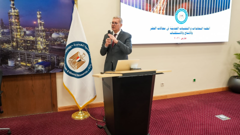
This is not the only move Egypt is undertaking regarding the deployment of innovative technologies for optimizing exploration and production activities. Sherif Bayoumy, Managing Director of SLB Egypt and East Mediterranean, revealed during the 11th Egypt Oil and Gas Convention (EOGC) the company’s plans in Egypt, reshaping drilling and production operations.
“We are going to launch our first local cloud in the first quarter (Q1) 2026. We are going to start to look in drilling efficiencies across the sector. We also are going to launch edge solutions at the well site. It’s a blackbox where you can fit in any facility or wellhead that communicates with the data center or with the cloud,” said Bayoumy.
He noted that the cloud will optimize automation for drilling activities enabling operators and entities like EGPC or EGAS to monitor efficiencies. “This will result in reduction of invisible lost time and so many other things, and inherently increase or accelerate production, because the more that you save efficiency, that you build up.”
He added that SLB has already carried out four pilot automation projects across Egypt, in the Western Desert, Mediterranean, Eastern Desert, and the Gulf of Suez, delivering “very interesting results” and clear value for operators.